
Drones have reinvented mapping and surveying for construction, agriculture, and mining professionals, offering efficiency, versatility, and superior data collection. Unmanned Autonomous Solutions drones have effectively advanced cartography, photogrammetry, remote sensing, geographic information systems (GIS), land surveying, hydrography, and cadastral surveying capabilities.
By deploying Unmanned Autonomous Solutions drones, you can capture high-resolution aerial data swiftly and cost-effectively, enhancing precision with GPS integration. Your unmanned aerial system can access challenging terrain, accelerating surveys and cutting operational costs. Your drone fleet is pivotal in urban planning, environmental monitoring, and infrastructure development, providing timely spatial data for informed decisions.


Aerial surveys gather data quickly and accurately, vital for topographic mapping, site planning, and creating precise 3D models.
Regular monitoring improves project oversight, detects issues early, and manages construction efficiently, ensuring progress tracking, quality control, and issue identification.
Close-up inspections detect defects early, reducing manual inspections and improving overall construction quality, ensuring quality assurance for structures and critical components.
Real-time sharing of aerial views and project updates enhances collaboration and transparency among team members, clients, and stakeholders, facilitating effective project management.
Surveillance of construction sites improves job site safety, responds quickly to emergencies, and enhances security measures, contributing to safety monitoring and hazard identification.
Generating time-lapse videos and progress reports using drone imagery visualizes project evolution, communicates milestones effectively, and reports progress transparently to stakeholders.
Monitoring and assessing environmental impact ensures compliance with regulations, identifies potential issues early, and promotes sustainable construction practices, contributing to environmental compliance and sustainability.
The use of unmanned aerial systems in construction has served project management by providing exceptional insights into worksite progress and facilitating efficient data collection. With the ability to conduct aerial surveys and capture high-resolution images, drones offer a swift and precise alternative to traditional ground-based methods. This technology enhances safety, accuracy, and project oversight, ultimately improving efficiency and cost-effectiveness throughout the construction process.
Construction Site Mapping, 3D Modeling, Building Information Modeling (BIM)
Project Management and Site Monitoring
Construction Documentation
Volume Measurements and Earthworks
Bridge Infrastructure Inspection


Drones have emerged as an essential technology in the mining industry. Equipped with sophisticated sensors and cameras, drones conduct aerial surveys, delivering precise topographical maps crucial for resource exploration and planning. These platforms also play a pivotal role in safety inspections, environmental monitoring, and infrastructure assessment, ensuring compliance and efficiency across mining sites. By streamlining processes and promoting sustainability, unmanned systems are reshaping the landscape of mining operations, offering unprecedented insights and benefits to the industry.
LiDAR Sensor Topographical Mapping of Mining Sites
Geological Terrain and Mineral Exploration, Environmental Impact Monitoring
Quarry Planning and Monitoring
Stockpile Management
Mine Reclamation Monitoring
Infrastructure Inspections
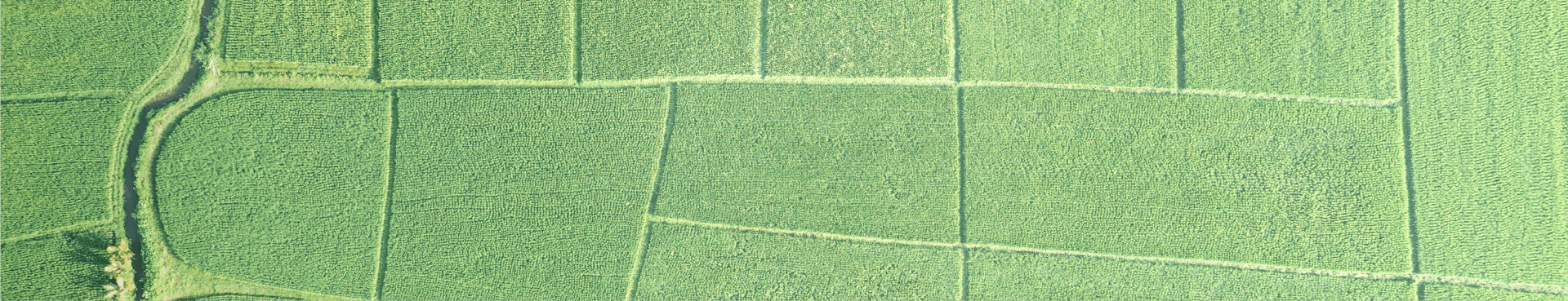
Agriculture practices have evolved with the introduction of unmanned systems. Unmanned Autonomous Solutions drones offer innovative solutions to longstanding challenges in modern farming practices. Equipped with advanced sensors and cameras, drones revolutionize crop management by providing real-time insights into crop health, growth patterns, and potential issues. Through precision agriculture techniques facilitated by GPS technology, drones optimize resource use and increase yields while reducing environmental impact. With benefits including increased efficiency, cost-effectiveness, and sustainable practices, drones have become indispensable tools for farmers striving for optimal crop management and yield enhancement.
Crop Yield and Livestock Monitoring
Planting and Seeding
Water/Moisture Monitoring
Crop Spraying, Disease and Pest Control, Weed Detection and Management

Contact the Mapping & Surveying experts at Gresco Unmanned Autonomous Solutions


.svg)
