


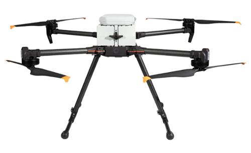
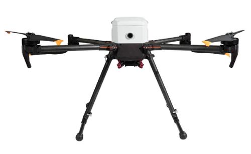


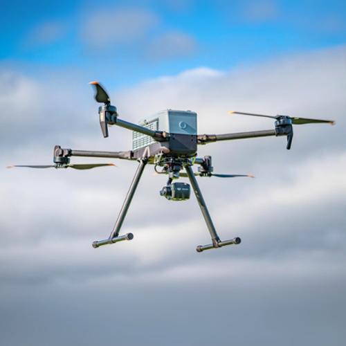
The IF800 Tomcat is a medium-lift quadcopter drone designed by Inspired Flight Technologies. This aerial platform offers an impressive maximum flight time of 54 minutes and can carry a payload of up to 6.6 pounds (approximately 3 kilograms). This drone stands out as a remarkable blend of cutting-edge technology and user-friendly design. Its robust capabilities make it an ideal choice for various professional applications, including high-resolution aerial photogrammetry, surveying, search and rescue, and infrastructure inspection.
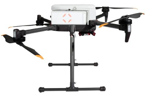
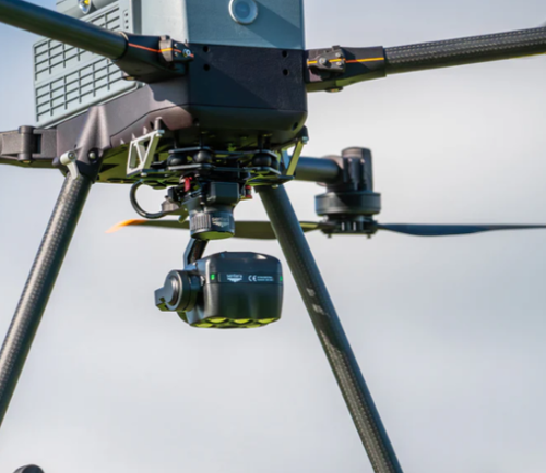
This version of the IF800 Tomcat bundle comes equipped with Sentera 6X payload, a state-of-the-art payload designed specifically for precision agriculture. The sensor captures eight channels of image data, offering advanced imagery that can help farmers make informed decisions about their fields, informing trait selection, and product development decisions. One of the standout features of the 6X Sensor is its fast-frame rate performance coupled with high radiometric accuracy, ensuring reliable and timely data. Additionally, the built-in 320 x 256 Boson® thermal sensor provides pixel-level temperature measurement, delivering thermal accuracy of ±5°C and accurate thermal maps at a specific ground sample distance (GSD). This combination of features makes the Sentera 6X Sensor a powerful tool in modern agriculture as it delivers science-grade imagery.
It's becoming a standard practice of integrating UAS products into various fields, perpetually employed to manage operations of the highest intensity including, Defense Operations, Utility Inspections, Mapping, and Public Safety. Defense Operations, Utility Inspections, Mapping, and Public Safety are four distinct yet interconnected domains. Defense Operations involve strategic activities designed to protect and defend a country’s national interests, often employing advanced technologies and rigorous training programs. Utility Inspections refer to the systematic examination of infrastructure systems like electricity, water, and gas to ensure their optimal operation and safety. Mapping is the process of creating visual representations of geographical areas, which is crucial for planning, decision-making, and navigation in various fields. Lastly, Public Safety encompasses measures and systems put in place to protect the public from dangers, including emergency response services and law enforcement. Together, these four areas form a comprehensive framework for maintaining societal order and safety.
Bundle Specification:
Camera Features:
Multispectral
Thermal
Bundle Includes:
There are currently no resources for this product.