View Cart $-.--
0
View Cart $-.--
0
Home Sensors & Payloads LiDAR WINGTRA LIDAR PAYLOAD INCLUDING 1-YEAR OF LIDAR LICENSE

WINGTRA LIDAR PAYLOAD INCLUDING 1-YEAR OF LIDAR LICENSE

PART LIDAR-HW-incl1yearLicense
SUPPLIER Wingtra AG
Calculating price...
QUANTITY

About this item

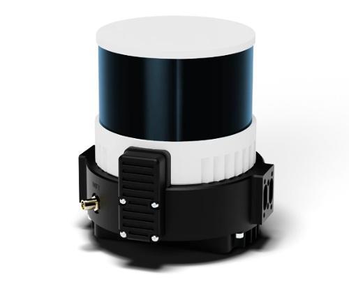
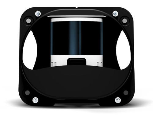
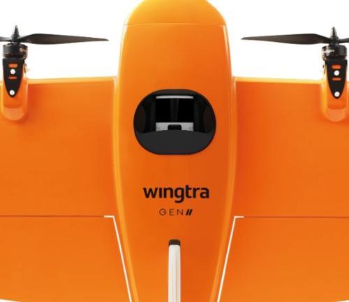
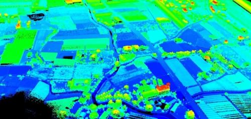
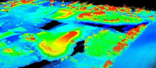
The Wingtra LiDAR payload with a 1-year LiDAR license is engineered for high-precision aerial mapping and surveying across diverse environments. Designed to integrate seamlessly with the WingtraOne GEN II drone, this solution combines a top-tier Hesai laser scanner, NovAtel GNSS positioning, and Inertial Labs IMU for accurate georeferencing and orientation. It enables efficient data capture for applications such as construction site monitoring, urban planning, forestry analysis, and mining operations. With its ability to penetrate vegetation and deliver consistent accuracy, the system supports professionals who require reliable terrain models and detailed point clouds for CAD and GIS workflows.

The included 1-year LiDAR license provides access to advanced processing tools for classification, analysis, and streamlined data conversion, ensuring smooth integration into industry-standard platforms. This package minimizes setup time and accelerates post-processing, reducing field hours and enabling faster project turnaround. Its robust design and automated workflow make it ideal for organizations seeking dependable performance in demanding conditions.

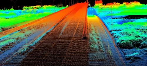
From construction to forestry, Wingtra LIDAR provides accurate insights to support complex, real-world applications.

Minimize costly rework with accurate data

LIDAR surveys offer accurate site data for every stage of construction, for sharper decision-making and less rework.
 

Get accurate high-res topographic data

Move beyond traditional methods to manage land much more efficiently and precisely based on high-resolution data and georeferenced maps.


Forest biomass stress and disease monitoring

Accurately assess biomass, monitor growth rates, and support forest health by detecting stress and disease early.
 

Same-day data for keen operational decisions

Get accurate, same-day data to make better decisions based on current reality without disrupting ground operations.
 

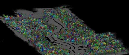
Base your decisions on high quality reliable data thanks to best-in-class components and an optimized 3-return system for robust vegetation penetration.

 
Vertical accuracy
down to 3 cm (1.2 in) Consistent accuracy thanks to the top-tier LIDAR sensor and Inertial Labs IMU.
 
Up to 3
optimized returns
Delivers sharp, clear data without noise from unnecessary returns.
 
Superior
strip alignment
Data aligns right out of the drone, reducing post-processing time and “editing.”


Key Features:

  • Hesai XT32-M2X laser scanner with up to 3 returns for vegetation penetration
  • Effective point rate of 480,000 points per second
  • Vertical accuracy down to 3 cm with optimized strip alignment
  • Integrated NovAtel GNSS module for precise georeferencing
  • Inertial Labs tactical-grade IMU for accurate orientation
  • Maximum LiDAR range of 300 m with adjustable flight height for point density
  • Seamless integration with WingtraOne GEN II and WingtraPilot software
  • 1-year LiDAR license for advanced data processing and classification


WINGTRA LIDAR PAYLOAD SPECIFICATION SHEET

Qty 1- LIDAR Payload for WingtraOne GEN II

Qty 1- GEN II Top Cover

Qty 1- 256 GB Storage Device

Qty 1- Payload Case

Qty 1- Year LIDAR License (Hardware activation and unlimited app usage)