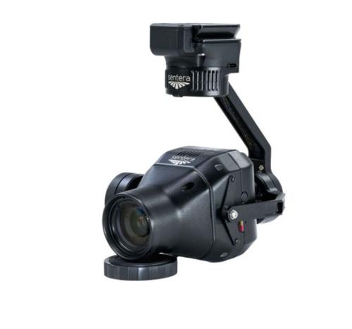
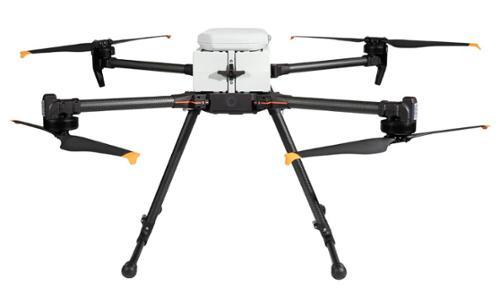
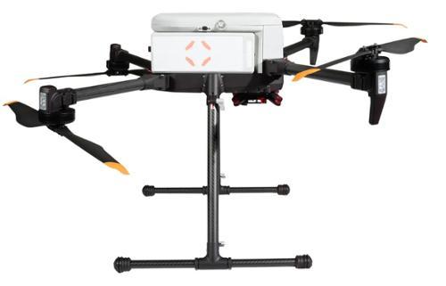
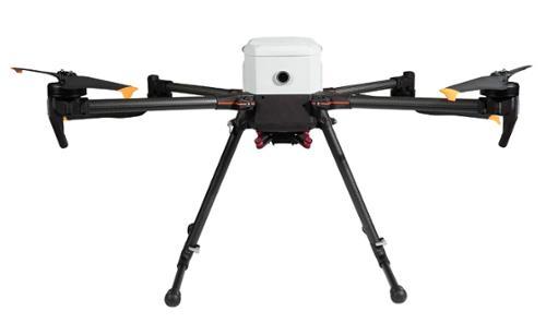
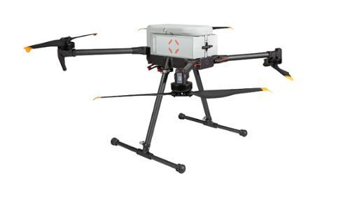
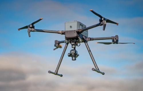
The IF800 TOMCAT SENTERA 65R BUNDLE is a medium-lift quadcopter drone engineered by Inspired Flight Technologies for advanced aerial data collection and precision mapping. This platform offers a maximum flight time of 54 minutes and supports payloads up to 6.6 pounds, making it suitable for high-resolution photogrammetry, surveying, search and rescue, and infrastructure inspection. The Sentera 65R payload is an ultra-high-resolution precision sensor designed for seamless integration with drone systems, including RTK compatibility. With a ground sampling distance of 0.45 cm per pixel and a resolution of 9344 x 7000 pixels, the Sentera 65R enables users to cover more ground faster and generate detailed data for surveying, modeling, and mapping applications.
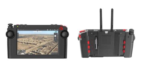
Key use case applications for the IF800 TOMCAT SENTERA 65R BUNDLE include defense operations, utility inspections, mapping, and public safety. The drone’s foldable and portable design, hot-swappable smart batteries, and robust build ensure reliable performance in demanding environments. The bundle includes the Vision2 ground controller with Doodle Labs radio, a rugged transport case, two batteries, and a charger, supporting efficient workflows and extended missions. The IF800 TOMCAT is listed on the Blue UAS cleared list, ensuring compliance for government and enterprise deployments.
|
Higher Resolution, Faster CoverageWith an ultra‑fine ground sampling distance of 0.45 cm per pixel, the system captures significantly more detail in every image, improving both accuracy and efficiency. By collecting more usable data per shot, it enables substantially faster area coverage compared to conventional cameras.
|
Designed for Seamless Drone IntegrationThe 65R is purpose‑built for straightforward integration with drone platforms, delivering ultra‑high‑resolution aerial imagery that supports accurate, data‑driven decisions in surveying and mapping workflows.
|
Optimized Data OutputsFrom high‑resolution RGB mosaics to detailed digital surface models and advanced analytics, the 65R delivers the right data products for your mission, supporting efficient surveying, modeling, and mapping workflows.
|
Qty 1- IF800 Tomcat Aircraft
Qty 4- Propellers
Qty 1- Vision2 Ground Controller with Doodle Labs Radio
Qty 1- Rugged Transport Case
Qty 1- Sentera 65R Payload
Qty 2- Batteries
Qty 1- Charger